Flooding risks around Frognal
The Redington Frognal Area borders Kenwood House Quarry, a Regionally Important Geological and Geomorphological Site (GLA 42), which the London Plan seeks to protect and promote. It is situated on unstable soils (London clay, Claygate Member and Bagshot Formation) above a large body of underground water, including the underground River Westbourne (also known as the Cannon) and its tributaries, and the local authority is designated a “Lead Local Flood Authority”.
Further information is provided under the following headings:
Camden Flood Risk Management Strategy 2022-2027
The Camden Flood Risk Management Strategy 2022-2027 (FRMS) sets out how Camden Council and partner authorities will work together to manage flood risk and increase resilience across the borough until 2027. The Council has produced the FRMS under the requirements of the Flood and Water Management Act 2010.
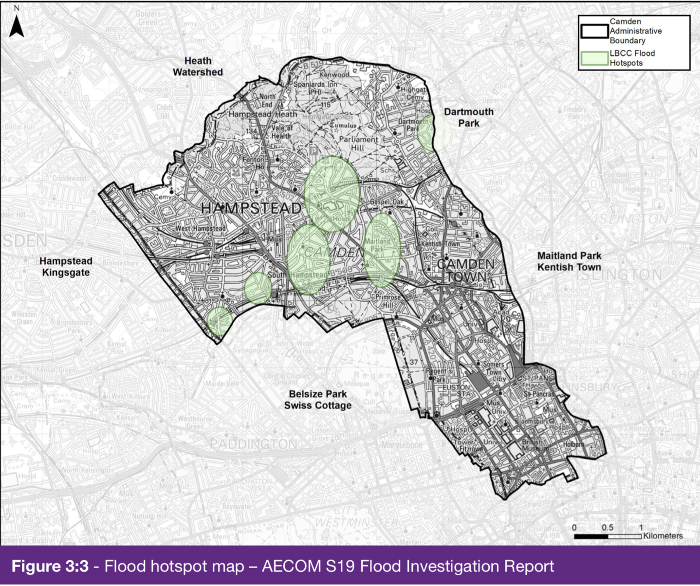
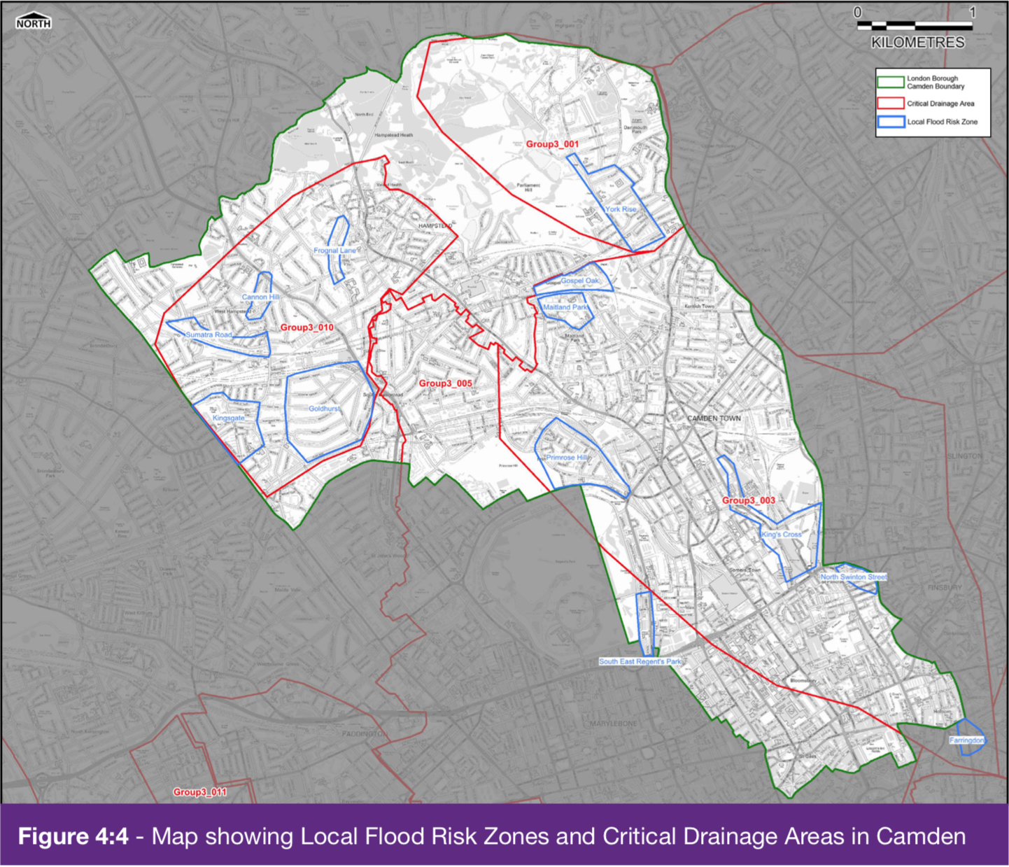
Major flooding incidents took place in Camden in 1975, 2002, 2021 and on 17 August 2022. The primary flood risk in Redington Frognal is from topography.
Responses to the Camden consultation were taken up to 9 October, 2022.
The full report is available here:
Managing flood risk in Camden – Camden’s Flood Risk Management Strategy
Extreme weather through the ages
Frognal has been affected by several extreme weather events, as outlined by Prof. Lester Hillman in his address to the AGM of Redington Frognal Association, held on 12 October 2025: