Due to the importance of trees to the environment within Camden, we have collated further information on the additional pages listed below:
- Street trees in Camden
- Trees on private land within the RedFrog area
- Veteran trees within the Redfrog area
The Value of Trees
Trees and vegetation are highly valued in Camden, in part due to the borough’s dense urban environment. Trees and other woody vegetation are integral to Camden’s character and quality of life. They soften the impact of buildings and structures and integrate them into their setting.
Trees can also be landmarks in their own right and provide the conditions for economic success because people and businesses are more likely to invest in environments with trees and planting.
Trees are particularly valuable green infrastructure elements because of the multiple benefits they provide. A canopy cover level of 40% is generally considered optimal to maximise ecosystem services, in addition to health and wellbeing benefits, notably:
- particulate filtration;
- shading and cooling;
- reduced heat island effect;
- support for biodiversity;
- attenuation of surface water runoff, in an area prone to surface water flooding downstream, eg at the junction of Heath Drive and Cannon Hill, outside the West Hampstead fire station and in Lymington Road;
- absorption of a range of harmful gases, including carbon dioxide, sulphur dioxide and carbon monoxide;
- proven benefits for health and wellbeing, including improved recovery times from illness, and reducing stress;
- prevention of harm to the “green and leafy character” of Camden’s Conservation Areas;
- noise abatement;
- creating a strong sense of unity and identity in a place and reductions in violence and crime;
- increased property values.
The harmful impact of declining canopy cover
Fellings in private gardens and pollarding of street trees has produced a serious decline in canopy cover, harming the green and leafy character of the Redington Frognal Conservation Area.
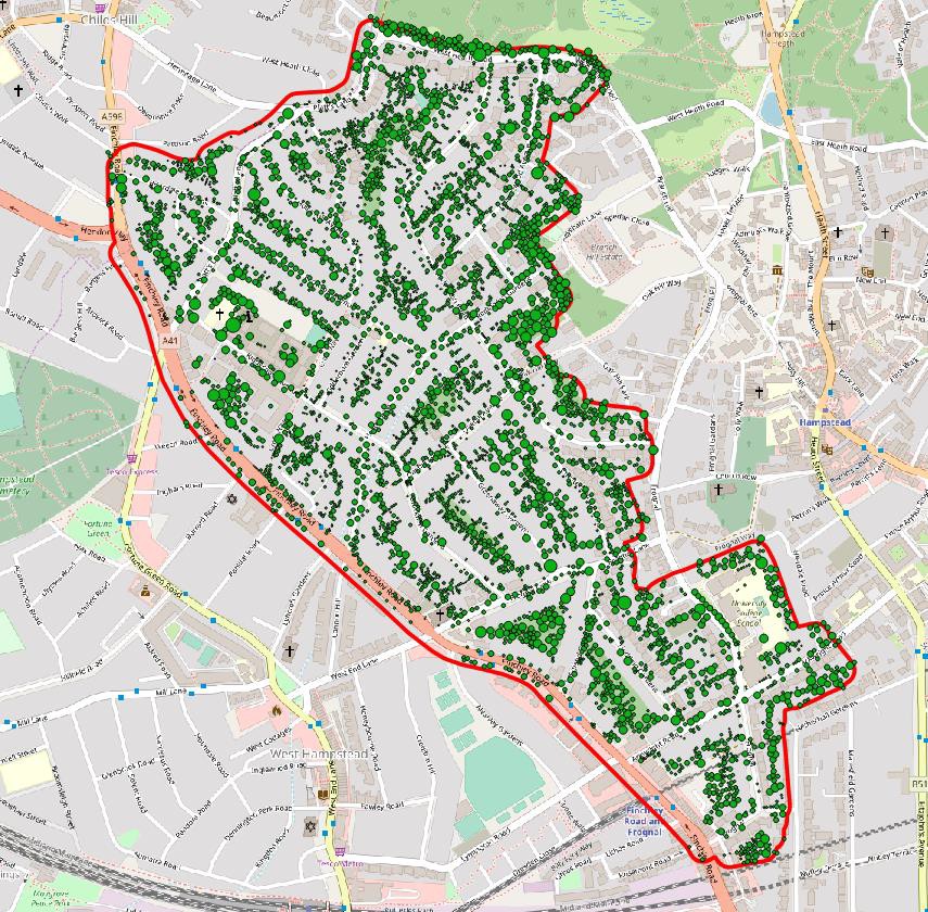
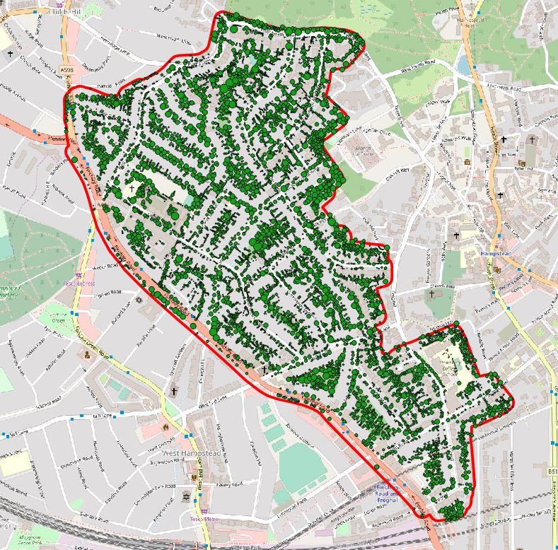
Aerial imagery from Bluesky International shows that the tree canopy cover in the Redington Frognal area fell from 31% in 2010 to 23% by 2016, with the total tree count dropping from 8009 to 5062. It is likely to have continued to decline.
Map of Tree Distribution in 2010
Note: ProximiTREE data is a bespoke tree mapping dataset which is created manually by our photogrammetrists using stereo aerial imagery to edit every single tree polygon present in the aerial imagery. This dataset is NOT available nationally due to the huge amount of editing required which in turn makes it uneconomical to create on such a large scale.
Map of Tree Distribution in 2016